|
Participants | Visitors | Home |
|
|||||||||||||||||||||||
|
|
|||||||||||||||||||||||
| News | ||
| About | ||
| Background Scientific Data |
||
| Study Sites | ||
| Logistics | ||
| Daily Plan-It | ||
| Activities | ||
| Photos | ||
| Data Archive | ||
| Forecast | ||
| Measurements | ||
| Aircraft | ||
| Participanting Organizations | ||
| Related Links | ||
 |
||
| Background Scientific Data > Emission Inventory Data > Maps 1-4 | |||||||||||||||||||||||||||||||||||||||||||||||||||||
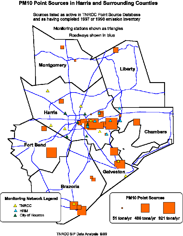
Emission Inventory Data These maps represent point sources of emissions of non-methane organic compounds, nitrogen oxides, sulfur dioxide, and PM-10 for the 8-county Houston-Galveston-Brazoria non-attainment region. The maps are intended to be useful for sampling site selection and aircraft flight plan development. They represent summaries of much more detailed inventories that include chemical characterization of the emissions, as well as details of spatial and temporal allocation of the emissions. These more detailed emission inventories will be assembled as the study progresses. Click on any thumbnail below to see a full-sized representation of that map. The map will open in a separate browser window.
|
|||||||||||||||||||||||||||||||||||||||||||||||||||||
|
|
This site created by the Instructional Media Lab |